Getting Around Cairns: Do You Need a Car?
Do you need a car to get around Cairns?
No, not for the reef or Kuranda — both run as excursions with hotel pickup in Cairns, Palm Cove and Port Douglas. A rental car earns its cost for the Atherton Tablelands and the coast north and south of Cairns, where public transport is thin.
Working Out What You Actually Need
Tropical North Queensland covers a lot of ground: a compact city centre, a string of northern beaches, a rainforest coastline, and a cool volcanic plateau inland. None of it needs the same kind of transport. The mistake most first-time visitors make is renting a car for the whole trip, then discovering the two most-booked experiences — the Great Barrier Reef and Kuranda — don’t use it at all.
This guide covers the roads, the rules, and the honest answer to “do I need a car” for each part of the region. For the airport itself, see the separate Cairns Airport guide, and for the specific run up to Port Douglas, see Cairns to Port Douglas transport — neither is covered in detail here.
Driving Rules and Road Conditions
Australia drives on the left, with the steering wheel on the right side of the car. Roundabouts run clockwise. For visitors used to right-hand traffic, the two moments that catch people out are the first roundabout and the first left turn against a red light (permitted at some intersections, signed when it is). Give yourself a quiet stretch of road, ideally straight out of the rental depot, before hitting the city centre.
Major roads around Cairns are sealed and in good condition: the Captain Cook Highway north to Port Douglas, the Kennedy Highway up to Atherton Tablelands, and the Bruce Highway south toward Innisfail and Mission Beach. Speed limits sit around 100–110 km/h on the open highway and drop sharply through towns — cameras and highway patrols are active, and fines for tourists are enforced the same as for locals.
Fuel stations thin out fast once you leave the coastal strip. Between Daintree Village and Cape Tribulation there is effectively none, and once across the Daintree River, mobile coverage becomes patchy to absent. Fill the tank before you cross, and don’t rely on a phone map working the whole way.
Kangaroos and Cassowaries at Dawn and Dusk
The single biggest driving hazard in this region isn’t traffic — it’s wildlife crossing at low light. Kangaroos and wallabies move at dawn and dusk on rural roads everywhere in the Tablelands and along the coastal highways, and a collision at highway speed can total a car and injure the driver as well as the animal.
The far more serious version of this warning is the southern cassowary. Around Mission Beach especially, “Cassowary Crossing” road signs are not decorative — this endangered bird, of which only around 4,000 remain in the Wet Tropics, is struck and killed on regional roads most years. If you see a cassowary near the road, slow right down, do not stop to photograph it from the car, and never attempt to feed it. Full detail on cassowary behaviour and where to look for one safely is in the cassowary spotting guide.
The practical rule for both animals: treat the hour either side of sunrise and the hour either side of sunset as reduced-visibility hours on any road outside the city centre, and slow down accordingly, particularly on the Captain Cook Highway, the roads around Kuranda, and anywhere on the Atherton Tablelands.
Wet Season Roads: “If It’s Flooded, Forget It”
From November to April, Tropical North Queensland’s wet season turns creek crossings and low-lying roads into genuine hazards. “If it’s flooded, forget it” is an official Queensland road safety campaign line, not a slogan — the advice behind it is that floodwater depth and current are impossible to judge from the driver’s seat, and cars are swept off flooded causeways every year, sometimes fatally. Never drive, wade, or ride through a flooded section of road, regardless of how shallow it looks or how many other cars have already crossed.
In practice this means checking road conditions before setting out on any wet-season drive beyond the city, particularly toward the Atherton Tablelands or the southern coast around Babinda — one of the wettest towns in Australia, at around 4,000mm of rain a year — and Tully. If a section is barricaded or signed as closed, that is final; there is no local shortcut. Cyclone season runs the same months, and low-lying roads can close for days after a major system, so build flexibility into a wet-season itinerary rather than a fixed schedule.
Where a Car Actually Helps
A rental car earns its cost in three places:
- The Atherton Tablelands — the waterfalls, crater lakes, and villages of the plateau are spread across a wide area with limited public transport, and having your own vehicle lets you set your own pace between stops like the Waterfall Circuit and Lake Eacham. See the Atherton Tablelands day trip guide for a full route.
- The northern beaches and coast — beyond the main Palm Cove strip, having a car makes it easy to string together stops along the Captain Cook Highway at your own schedule rather than a tour’s.
- The southern coast towns — Innisfail, Paronella Park, Babinda and Mission Beach are loosely connected by public transport at best, and a car turns a long, multi-connection day into a straightforward drive.
Where a Car Doesn’t Help — And Costs You Money For Nothing
This is the trap worth avoiding: renting a car for the reef or for Kuranda is money spent for no added access. Neither destination is reached by simply driving there and parking.
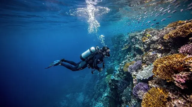
Great Barrier Reef trips leave from the Cairns Reef Fleet Terminal (or from Port Douglas for reefs further north) on a fixed boat schedule, and almost every operator includes hotel pickup as standard for guests staying in Cairns, Palm Cove, Trinity Beach and Port Douglas. Turning up with your own car just means paying for parking near the terminal instead of a courtesy shuttle. The full range of reef trip options is in the Great Barrier Reef from Cairns guide.
Kuranda works the same way. The Skyrail Rainforest Cableway and the Kuranda Scenic Railway both depart from set stations — Smithfield and Freshwater respectively — and the classic way to do the day is one route up, the other back down, which only works cleanly with a transfer service or a packaged tour, since a self-driven car ends up on the wrong side of the loop. Most Kuranda day packages include hotel pickup from Cairns and the northern beaches. Details on planning the day are in the Kuranda day trip guide and the Skyrail vs Scenic Railway comparison.
If your entire trip is built around the reef, Kuranda, and staying close to central Cairns, you may not need a rental car at all — see the dedicated breakdown in do you need a car in Cairns.
No Road Bypasses the Daintree River Ferry
One geographic fact catches out a surprising number of visitors planning their own driving route: there is no bridge across the Daintree River, and no road route to Cape Tribulation that avoids it. The only way across by vehicle is the Daintree River cable ferry, a small vehicle ferry that runs on a continuous shuttle from early morning until midnight. It is a paid crossing, taken per vehicle, and it is the single choke point for anyone driving north from Daintree Village toward Cow Bay or Cape Tribulation.
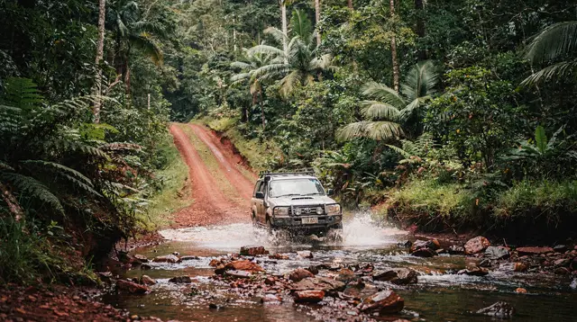
Beyond the ferry, the sealed road continues to Cape Tribulation, but the only route further north — the Bloomfield Track toward Wujal Wujal and Cooktown — is a 4WD-only unsealed track, frequently impassable or closed outright in the wet season, and excluded from almost every standard rental car contract. Do not plan to continue past Cape Tribulation in a standard hire car under any circumstances. Full route planning for the drive itself, including fuel and connectivity gaps, is in driving to Cape Tribulation.
Getting to the Reef and Kuranda Without a Car
Since neither of the region’s two biggest draws needs a car, most visitors are better served figuring out transfers instead. Hotel pickup is included in the large majority of reef and Kuranda bookings from Cairns, Palm Cove and Port Douglas — check the specific listing when booking, since it is nearly universal but not guaranteed on every product. Airport transfers work the same way for the start and end of a trip: a pre-booked transfer between Cairns Airport and your hotel removes the need to arrange a taxi or rideshare on arrival, particularly useful for late-night or early-morning flights.
For getting around the city itself without a car, a hop-on hop-off bus covers the Cairns Esplanade, the Reef Fleet Terminal, and the main shopping and dining strips on a loop, which is a reasonable way to string together a day of independent sightseeing in the centre:
a hop-on hop-off loop around central CairnsOn the Water Instead of on the Road
Trinity Inlet and the coastal waters around Cairns are worth thinking of as an alternative transport layer, not just a scenic backdrop. Several operators offer small self-drive boats by the hour, a genuinely different way to see the inlet and nearby mangroves without a licence beyond a basic safety briefing:
a self-drive tinny hire on Trinity InletFor a faster, guided look at the same waters, a short jet boat run works well as an add-on to a day in the city rather than a full excursion:
a 35-minute jet boat ride out of CairnsAnd for an evening out that doubles as transport and entertainment, a dinner cruise on Trinity Inlet covers sunset views without needing a car or a taxi at either end.
Remember that none of this water traffic is a substitute for the strict rule on the region’s rivers and estuaries: never swim in Trinity Inlet or any coastal river, since saltwater crocodiles live in every estuary and mangrove system along this coast, including inside city limits.
Comparing Your Options by Trip
| Trip | Best option | Why |
|---|---|---|
| Great Barrier Reef | Boat tour with hotel pickup | Fixed terminal departure; a car adds parking cost, not access |
| Kuranda | Skyrail + Scenic Railway package | One-way loop only works with transfer or tour, not a self-driven car |
| Atherton Tablelands | Rental car or guided day tour | Spread-out sights, limited public transport |
| Palm Cove / northern beaches | Rental car or transfer | Useful for exploring beyond the main strip |
| Cape Tribulation / Daintree | Rental car + Daintree ferry | Only road route; no bridge, no bypass |
| Bloomfield Track (Cape Trib to Cooktown) | 4WD tour, not a standard rental | Unsealed, wet-season closures, excluded from most hire contracts |
| Mission Beach / southern coast | Rental car or private tour | Thin public transport between towns |
| Cairns city centre | Hop-on hop-off bus or walking | Compact, well served without a car |
Practical Notes Before You Book
A rental car is worth budgeting for if your itinerary includes the Atherton Tablelands or independent exploring of the coast north or south of Cairns — see best day trips from Cairns for the areas this covers. It is not worth budgeting for if your trip is built mainly around reef trips and Kuranda, both of which are sold as complete packages with pickup included.
Whichever way you travel, keep the wildlife and flood rules in mind on every rural drive: slow down at dawn and dusk for kangaroos and cassowaries, and never attempt a flooded crossing regardless of how it looks. Both are seasonal, low-effort precautions that account for most of the serious road incidents reported in the region each year.
Frequently Asked Questions About Getting Around Cairns
Do I need to rent a car in Cairns?
Only if you plan to explore the Atherton Tablelands or the coast north and south of Cairns independently. Reef trips and Kuranda are sold as excursions with hotel pickup, so a car adds cost without adding access.
Can I drive to Cape Tribulation from Cairns?
Yes, but only via the Daintree River ferry, a small cable ferry that is the sole road link across the river. It is paid, cash or card, and runs from early morning to midnight; there is no bridge and no free alternative.
Is it safe to drive at night in Far North Queensland?
Kangaroos and cassowaries are most active at dawn and dusk on rural roads, so slow down sharply in those windows, especially on the Captain Cook Highway, around Kuranda, and on the Atherton Tablelands.
What does “if it’s flooded, forget it” mean?
It is an official Queensland road safety message, not just advice: never drive, walk, or ride through floodwater, since depth and current are impossible to judge and vehicles are swept away every wet season.
Which side of the road do you drive on in Australia?
The left, with the steering wheel on the right side of the car. Roundabouts also run clockwise, which catches out drivers used to right-hand traffic.
Do I need a car for the Great Barrier Reef or Kuranda?
No. Reef boats and the Skyrail or Kuranda Scenic Railway depart from set terminals with hotel pickup included in most bookings from Cairns, Palm Cove and Port Douglas, so a rental car is an unnecessary expense for either trip.
Is public transport enough to see Cairns without a car?
For the city, the northern beaches and organised day trips, yes. For independent exploring of the Atherton Tablelands or the southern coast towns, a car or a private tour is the practical option.
Transfers and transport on GetYourGuide
Verified deep-linked GetYourGuide tours. Book through these links and we earn a small commission at no cost to you.
GetYourGuide does not provide a product photo for this activity — the image shows the meeting point, photographed by us.