Do You Need a Car in Cairns?
Do you need to rent a car in Cairns?
No, not for the Great Barrier Reef or Kuranda, which run as boat and cableway trips with hotel pickup included. A car earns its keep for the Atherton Tablelands and the coast roads north and south of Cairns, where there is no scheduled public transport between the stops.
Cairns is one of the few travel questions that actually has a clean answer, and it depends entirely on which part of the trip you mean. Ask “do I need a car for the Great Barrier Reef” and the answer is a flat no. Ask “do I need a car for the Atherton Tablelands” and the answer is a flat yes. The confusion comes from treating Tropical North Queensland as one destination, when it is really three: a reef reached only by boat, a rainforest village reached only by cableway or rail, and an inland plateau and two coastlines that behave like ordinary road-trip country. Sort the region into those three pieces and the car question answers itself.
The Short Answer
If your Cairns trip is built around the reef, Kuranda and the city itself, skip the rental car entirely. Book an airport transfer into town, use hotel pickups for every excursion, and get around central Cairns on foot or with a hop-on hop-off bus pass for the northern beaches.
If your trip also includes the Atherton Tablelands, a self-drive loop north to Port Douglas and the Daintree, or the quieter towns south towards Mission Beach, then a rental car for those days — and only those days — is the right tool.
Plenty of visitors do both: no car for the first half of the trip, a car for a Tablelands loop or a Port Douglas run in the middle, then hand the keys back before flying out. For a fuller breakdown of buses, shuttles and transfer options for the no-car days, see getting around Cairns.
Where a Car Is Dead Weight
Two of the biggest-ticket items in Tropical North Queensland cannot be reached by road at all, and a third is actively worse by car.
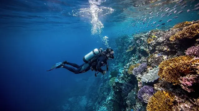
The Great Barrier Reef is offshore. There is no road to it, obviously, but the point is broader: every reef operator running from Cairns, Palm Cove or Port Douglas includes hotel pickup as standard, because their whole business depends on getting guests to the marina on time.
Turning up in your own car buys you nothing but a parking fee and the hassle of finding the right berth among a dozen boats. The same goes for the islands — Green Island, Fitzroy Island, the Frankland Islands — all boat-only, all pickup-included.
Kuranda is the second case, and it surprises people because it is technically drivable — there is a sealed road up the range. But almost nobody who visits Kuranda drives there, because the two ways up are the point of the trip, not a means to an end. The Skyrail Rainforest Cableway glides over the Barron Gorge canopy with stops at Red Peak and Barron Falls; the Kuranda Scenic Railway is a hand-built 1890s line through fifteen tunnels and ninety-three curves. Most visitors ride one up and the other down, with a transfer bus connecting the two ends. Driving yourself replaces both experiences with a car park in the village. See Skyrail and the Scenic Railway compared for how to combine them.
The third case is the city itself. Central Cairns is compact, flat and walkable — the Esplanade, the aquarium, Rusty’s Markets and the marina are all within a short stroll of most hotels — and parking downtown is limited and metered. A car adds cost and friction here without adding anything a five-minute walk doesn’t already cover.
Where a Car Earns Its Keep
The calculation flips completely once you leave the reef-and-rainforest core for the plateau and the coast roads.
| Region | Car needed? | Why |
|---|---|---|
| Great Barrier Reef & islands | No | Boat-only, pickup included |
| Kuranda | No | Skyrail / train is the experience |
| Central Cairns & northern beaches | Optional | Walkable, or hop-on hop-off bus |
| Atherton Tablelands | Yes | Scattered stops, no scheduled transit |
| Port Douglas & Daintree | Useful | Self-drive coast road, ferry-gated beyond |
| South coast (Babinda, Innisfail, Mission Beach) | Useful | Long distances between sights |
The Atherton Tablelands is the clearest yes. The plateau’s waterfalls, crater lakes and farms are spread across roughly an hour and a half of driving from Cairns, with the individual stops themselves ten to thirty minutes apart on quiet back roads that see no scheduled bus service at all.
The Millaa Millaa waterfall circuit, Lake Eacham and Lake Barrine, Yungaburra’s curtain fig and platypus creek, and the coffee farms around Mareeba only work as a single day if you control your own timing.
A small-group tour is the fallback for travellers who would rather not drive, but it trades flexibility for convenience — you see what the itinerary sees, at the pace it sets. If you’re weighing that trade-off against other Tablelands days, the two-day Tablelands itinerary lays out both approaches.
North of Cairns, the Port Douglas and Daintree run is a genuine self-drive route: the Captain Cook Highway hugs the coast for about an hour, with a worthwhile stop at Rex Lookout, and a standard rental car can continue past Port Douglas and Mossman, over the Daintree River ferry, and on to Cape Tribulation on sealed road.
Public transport along this corridor is thin and infrequent, which is exactly why a car (or a day tour, for a single day trip) is the practical choice here rather than the questionable one. The full case for that comparison — self-drive against organised transfer — is covered in Cairns to Port Douglas transport, which this guide deliberately leaves alone beyond the basic point: it’s one of the few Cairns-region drives that genuinely rewards having your own wheels.
South of Cairns, the coast towns — Babinda, Innisfail, Paronella Park, Mission Beach — are strung along the highway with real distances between them and no tourist shuttle network stitching them together the way Cairns-side excursions do.
A car makes a loose day loop possible; without one, the sensible move is to book the individual experiences as day tours, the way a guided Paronella Park day trip already bundles the return drive, entry and commentary on Jose Paronella’s story into one seat.
Driving on the Left, and the Two Things That Actually Cause Problems
Australia drives on the left, and for most visitors — including Americans driving on the right at home — the adjustment is smaller than expected once the first roundabout or two is out of the way. Tropical North Queensland’s roads outside Cairns itself are mostly single-lane-each-way and lightly trafficked, which helps. The two real hazards aren’t the road rules; they’re wildlife and weather.
Kangaroos, wallabies and cassowaries move at dawn and dusk, and country roads through the Tablelands and the coastal cane country carry real collision risk at those hours — slow down, and treat “Cassowary Crossing” signs as a literal instruction rather than decoration, since the southern cassowary is an endangered, genuinely dangerous bird that should never be approached on foot, let alone with a car. Driving after dark on rural roads in this region is worth avoiding altogether if the itinerary allows it.
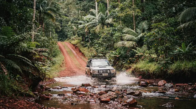
The second hazard is water, and it is worth taking more seriously than the wildlife. In the wet season, from roughly November to April, Tropical North Queensland’s rivers and low-lying roads flood fast, and Queensland’s own road safety guidance on this is deliberately blunt: if it’s flooded, forget it. Floodwater conceals washed-out surfaces, potholes and dropped edges, and moving water far shallower than it looks can float or sweep a car sideways.
This isn’t a slogan to nod at — flooded low-level crossings are a genuine, recurring cause of death in North Queensland during the wet season, and no scenic waterfall or crater lake is worth testing a crossing that looks even slightly uncertain. If a section of road is barricaded or a local warns you off it, that’s the end of the conversation, not a starting point for negotiation. For what that means for a wet-season Cairns trip more broadly — cyclone timing, which experiences hold up and which don’t — see Cairns in the wet season.
The Bloomfield Track and Other Places a Rental Car Can’t Go
One boundary is worth being explicit about, because it trips up more travellers than any wildlife or flood warning: the sealed road network north of Cairns simply stops at Cape Tribulation. Beyond it, the Bloomfield Track continues on to Wujal Wujal and eventually Cooktown, but it is an unsealed 4WD-only route, frequently closed or impassable in the wet season, and excluded outright from almost every standard rental agreement — driving it in a normal car voids your insurance even where the track itself is technically open.
If Cooktown or the far north is on your list, that’s a specialist 4WD tour or a dedicated 4WD rental, not an extension of the coastal drive you were doing that morning. The full detail on what the track requires and when it’s realistically driveable lives in the Bloomfield Track 4WD guide; the point for this page is simpler — know where your rental’s permission ends before you reach it.
A Practical Split for a Typical Trip
For a first Cairns trip of five to seven days, the pattern that works for most visitors looks roughly like this: no car for the reef days and the Kuranda day, since both come with pickup built in and a car adds nothing but a parking cost; a rental car picked up for a two- or three-day stretch in the middle to cover the Tablelands loop and, if time allows, a run up to Port Douglas and back; then the car returned before the last reef or city day. That split avoids paying for a car on days when it sits idle in a hotel car park, and it avoids the frustration of not having one on the one or two days it genuinely matters.
Travellers doing the whole trip without a car at any point — a valid choice, especially for a shorter stay — can see how the logistics work end to end in the four-day car-free itinerary, which leans on transfers, tours and the Skyrail/train combo instead. And if the whole question of how long to spend here is still open, how many days in Cairns is the place to work that out before booking anything.
One more point worth flagging for travellers weighing up a boat instead of a car for the coastal stretch: hiring your own small dinghy for a few hours on Trinity Inlet — a self-drive tinny hire — is a genuinely different way to see the estuary, but it is not a substitute for a car on land, and it comes with its own safety rule that matters as much as the flooded-roads warning above: this is crocodile habitat, and swimming from the boat or the banks is never part of the plan. For an evening on the water without driving anything yourself, a Cairns dinner cruise covers the same waterfront at a slower pace.
Cairns, Kuranda and the Car Question in Plain Terms
The short version bears repeating because it’s easy to overthink: nothing about the Great Barrier Reef or Kuranda improves with a car, and quite a lot about the Atherton Tablelands and the coast roads north and south of Cairns is hard without one. Match the tool to the terrain, hire the car only for the days that need it, and treat the flooded-road warning as a hard rule rather than a suggestion, and the driving side of a Tropical North Queensland trip stops being a source of stress and becomes just one more logistics decision, made once, before the mostly car-free rest of the trip carries on as planned.
Car Rental in Cairns: Frequently Asked Questions
Do I need a car to visit the Great Barrier Reef from Cairns?
No. Every reef trip departs by boat from Cairns Marlin Marina, Port Douglas or Palm Cove, and almost all operators include hotel pickup. Driving yourself only gets you to a car park, not onto the water.
Do I need a car for Kuranda?
No. Kuranda is reached by the Skyrail Rainforest Cableway or the Kuranda Scenic Railway, both with hotel transfers bundled into most tickets. Driving there skips the two experiences that make the trip worthwhile.
Is a rental car worth it for the Atherton Tablelands?
Yes. The waterfalls, crater lakes and coffee and cheese farms of the Tablelands are spread across a wide plateau with no scheduled public transport between them, so a car — or a small-group tour — is the only practical way to link more than one or two stops in a day.
Can I drive myself to Cape Tribulation and the Daintree?
Yes, in a standard rental car, as far as the Daintree River ferry and on to Cape Tribulation on sealed road. Beyond Cape Tribulation, the Bloomfield Track to Cooktown is 4WD-only and excluded from standard rental agreements.
Which side of the road does Australia drive on?
Left. Tropical North Queensland has few multi-lane roads outside Cairns itself, so the adjustment is usually easier than in a big city, but stay alert at roundabouts and when turning across traffic.
What do I do if a road is flooded in the wet season?
Turn around. Queensland’s own advice is blunt — if it’s flooded, forget it — because floodwater hides washed-out road surfaces and moves faster and deeper than it looks, and it is a leading cause of driving deaths in the tropics each wet season.
Do rental companies restrict where I can drive?
Most standard rental agreements exclude the Bloomfield Track, Cape York routes and other unsealed 4WD-only tracks, and driving them anyway voids insurance. Check the contract before you leave Cairns if you plan to go beyond Cape Tribulation.
Transfers and transport on GetYourGuide
Verified deep-linked GetYourGuide tours. Book through these links and we earn a small commission at no cost to you.
GetYourGuide does not provide a product photo for this activity — the image shows the meeting point, photographed by us.