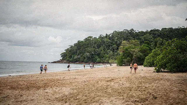
Hiking Barron Gorge National Park: Walks Near Kuranda
Can you actually walk in Barron Gorge, or is it just a train and cable car view?
Yes — Barron Gorge National Park has real walking tracks on foot, separate from the Skyrail gondola and the Kuranda Scenic Railway that most visitors use to see the falls. The historic Douglas Track and shorter lookout trails near Kuranda let you walk through the rainforest above the gorge itself, about 27 km and 330 m above Cairns.
Walking into the gorge on foot, not past it
Most people who come up to Barron Gorge never actually set foot in it. They ride the Skyrail Rainforest Cableway above the canopy, or take the Kuranda Scenic Railway along the old rail line, and both stop for a few minutes at a viewing platform over Barron Falls before continuing on to Kuranda. That experience is covered in full in our Skyrail and Kuranda Scenic Railway guide — this page is not that guide.
This one is about the gorge itself, walked on foot, on the network of tracks inside Barron Gorge National Park that the train and the gondola never touch. The park sits behind Cairns’s northern beaches suburbs, climbing from close to sea level up to Kuranda at roughly 330 m, about 27 km from central Cairns by road or rail. It is rugged, humid, thickly forested country, cut by the Barron River as it drops off the edge of the Atherton Tablelands toward the coastal plain — and it rewards a slower, on-foot visit as much as it rewards a scenic ride.
This is Djabugay and Bulwai country. The Barron River and its gorge have long-standing cultural significance for the Djabugay people, whose connection to this landscape predates any track, railway or cable car by a very long time. Walking here is a privilege, and it is worth remembering that as you go.
Getting to the trailheads
There is no single “Barron Gorge trailhead” — access points are spread along both ends of the gorge, and which one suits you depends on which walk you want.
- Kamerunga / Smithfield side (coastal end): reached from the northern suburbs of Cairns near Smithfield, close to where the Barron River meets the coastal plain. This is the lower, hotter end of the walking network.
- Kuranda side (top end): reached from Kuranda township itself, either by driving up the range road, taking the Kuranda Scenic Railway from Freshwater Station, or riding the Skyrail up from Smithfield and walking from the Kuranda terminal.
- Lake Placid side: Lake Placid, a calm bend of the Barron River just below the gorge, is a common turnaround or start point for shorter riverside walks, though — as covered below — it is a place to look at the river, not swim in it.
None of these points are directly linked by public transport designed for hikers, so most walkers either drive and arrange a car shuffle between two access points, join an organised bushwalking group, or treat the shorter tracks as out-and-back walks from a single trailhead rather than attempting the full point-to-point route.
The walks at a glance
| Walk | Distance / time | Difficulty | Best for |
|---|---|---|---|
| Douglas Track (full) | ~15 km one way, 6–8 hours | Hard, remote | Fit hikers wanting the classic through-walk |
| Douglas Track (Kamerunga end, out-and-back) | 4–8 km, 2–3 hours | Moderate | A taste of the historic pipeline route |
| Douglas Track (Kuranda end, out-and-back) | 3–6 km, 1.5–2.5 hours | Moderate | Rainforest walking without the full commitment |
| Short lookout tracks near Kuranda | 1–3 km, 30–90 minutes | Easy–moderate | Families, limited time, combining with the village |
| Riverside walking near Lake Placid | 1–2 km, 30–45 minutes | Easy | A gentle add-on, not a swim stop |
Treat the distances and times here as planning ranges rather than fixed numbers — track conditions, seasonal closures and personal pace all move them around.
The Douglas Track: the historic spine of the park
The Douglas Track is the main event for anyone who wants to genuinely hike Barron Gorge rather than glimpse it. It follows the route of Cairns’s original water supply pipeline, built in the early twentieth century to carry water down from the range to the growing coastal town — a reminder that this rugged corridor has been a working route through the gorge for well over a hundred years, long before the railway or the cableway existed.
Walked end to end, from the Kamerunga side near the coast up to Kuranda, it climbs steadily through dense rainforest, crossing creek lines, skirting sheer drop-offs into the gorge, and passing through pockets of forest that feel a world away from the beaches a short drive behind you. Because it climbs from near sea level to around 330 m while also covering real horizontal distance, it is a genuine full-day undertaking for a fit walker — reckon on six to eight hours depending on your pace, fitness and how often you stop at lookouts along the way.
Because it is a point-to-point track, not a loop, the practical question is always transport: how do you get back to your car, or back to Cairns, once you finish at the other end? Most walkers solve this one of three ways:
- Arrange for someone to drop you at one end and collect you at the other.
- Walk with a small group and leave a second vehicle at the finish.
- Join an organised bushwalking club outing, which typically handles logistics for you.
If a full-day, one-way wilderness walk with limited phone signal is more than you want to take on, the track is still worth experiencing in shorter bites — walking in an hour or two from either end and turning back gives a real sense of the forest and the historic route without the commitment of the whole thing.
Shorter walks near Kuranda
Not every visitor wants a six-hour hike, and Barron Gorge doesn’t require one. Around Kuranda itself, shorter walking tracks branch off into the surrounding rainforest and along sections of the gorge rim, giving a genuine walking experience in well under two hours.
These shorter tracks are the natural pairing for a Kuranda day trip: ride the Skyrail or the scenic railway up in the morning, spend an hour or so walking one of the shorter loops or out-and-back sections near the village, then browse Kuranda’s markets and attractions before heading back down. It is a good way to add genuine time on foot in the rainforest to a day that would otherwise be spent entirely on a train seat or in a gondola cabin.
a combined Skyrail and Kuranda Scenic Railway day tour is the standard way most visitors get up to and down from Kuranda, leaving the middle of the day free for walking, and it pairs naturally with time spent on the shorter tracks described here rather than the full Douglas Track.
Views without the walk: seeing the gorge from above
If your legs — or your schedule — don’t stretch to a hike, the gorge is also visible from the air. A short scenic flight over Barron Gorge and its falls gives a completely different perspective from the ground-level walking tracks: the full scale of the gorge cutting through the range, the rainforest canopy stretching to the horizon, and the falls themselves seen from directly above.
a 20-minute scenic flight over Barron Gorge and the falls is a genuinely different way to take in the same landscape covered by the walking tracks in this guide, and it works well either as a stand-alone activity or as a treat added onto a walking day.
For a longer, guided way to combine walking, waterfalls and the rainforest without navigating logistics yourself, a half-day 4WD rainforest waterfall tour takes in forest walking stops and waterfall lookouts around the Cairns hinterland with a driver-guide handling the route.
The safety rule that never changes: no swimming in the gorge
However tempting the Barron River looks from a lookout — and in places, with pools and rock formations, it looks genuinely inviting — do not swim in Barron Gorge or the lower Barron River. This is not a rule specific to this park; it is the same rule that applies across every estuary, tidal river reach and mangrove-lined waterway on the Far North Queensland coast, because saltwater crocodiles use exactly this kind of habitat, and the lower Barron River and its gorge fall within that range.
The safe places to cool off in fresh water near Cairns are the signed upland swimming sites well away from tidal and estuarine influence — Crystal Cascades, Behana Gorge, Babinda Boulders (within its clearly marked safe pool only) and the swimming holes around Mount Bartle Frere and Wooroonooran National Park.
None of those are inside Barron Gorge. If you want the full explanation of why this rule exists and how it is enforced across the region, our guide to seeing crocodiles safely sets it out in detail. In Barron Gorge itself, the water is for looking at, not for getting into.
What’s actually in the forest
Barron Gorge National Park protects a slice of the Wet Tropics of Queensland World Heritage Area, and walking through it — rather than gliding over it — is the best way to notice what makes that listing more than a line on a map. Buttressed rainforest trees, tangled vine forest, epiphytes clinging to branches high overhead, and a soundscape dominated by cicadas by day and frogs after rain. Birdlife is a highlight: keep an ear and an eye out along quieter stretches of track, particularly early morning, when the forest is most active and least crowded.
The gorge itself is a dramatic piece of geology as much as biology — the Barron River has cut down through the edge of the Atherton Tablelands here over a very long time, and walking along its rim gives a sense of scale that a train window or a gondola cabin can flatten out.
Practical planning: when and how to go
Best season: Dry season, roughly May to October, is by far the more comfortable and reliable window for serious walking here. Trails are firmer, humidity is lower, and the risk of sudden heavy rain making a creek crossing or a steep section unsafe is much reduced. Wet season walking is possible on the shorter tracks near Kuranda but is a poor idea on the full Douglas Track, where conditions can deteriorate quickly and remoteness compounds any problem.
What to bring, even for a short walk:
- At least two litres of water per person — the tropical humidity dehydrates faster than the temperature alone suggests.
- Sturdy, closed footwear with grip; the tracks are often uneven, root-covered and can be slick after rain.
- Sun protection and insect repellent, applied before you start, not once you notice a problem.
- A hat and light, breathable clothing rather than heavy hiking gear — the heat and humidity, not the cold, are the challenge here.
- For the Douglas Track specifically: a paper map or a downloaded offline map, since mobile phone coverage drops out in sections of the gorge, and a plan for transport at the finish end that you’ve confirmed before you start walking.
Fitness and experience: The shorter tracks near Kuranda suit reasonably fit families and casual walkers. The full Douglas Track is a different proposition — a long, humid, hilly day walk best suited to people who already walk regularly, ideally with at least one experienced hiker in the group if it’s a first attempt.
Combining a walk with the rest of Kuranda
Because the walking tracks sit right beside one of the most popular day-trip towns in the region, it’s easy to build a walk into a broader day rather than treating it as a separate outing. A morning on one of the shorter tracks pairs naturally with an afternoon exploring Kuranda’s animal parks and markets — Birdworld, the Kuranda Koala Gardens, or the cultural and wildlife experiences at Rainforestation Nature Park.
an entry ticket to Rainforestation Nature Park is a straightforward way to fill the rest of the day after a morning walk, combining Army Duck rides through the rainforest with the Pamagirri cultural experience. For a longer, fully guided day that folds transport, the railway or Skyrail, and rainforest time into a single booking, a combined Kuranda Scenic Railway and Skyrail rainforest day tour is the version to look at if you’d rather not plan the logistics yourself.
If your time in the region stretches beyond a single day, our three days in Cairns itinerary and broader best day trips from Cairns planning guide both cover how a Barron Gorge walk slots in alongside the reef, the Daintree and the rest of the Tablelands.
Don’t confuse this with the train or the Skyrail view
It’s worth repeating plainly, because the confusion is common: Barron Gorge National Park’s walking tracks are not the same experience as riding the Skyrail or the Kuranda Scenic Railway. Those two attractions carry you above or alongside the gorge and stop briefly at paved viewing platforms over Barron Falls — a wonderful, easy way to see the falls, and the right choice for most visitors on a single day trip, but a fundamentally different experience from walking on foot through the forest and along the gorge rim.
If what you actually want is the classic Barron Falls lookout view from the train or the gondola, our dedicated Barron Falls guide and Skyrail versus Scenic Railway comparison are the pages to read instead of this one. This guide is for the walk itself.
Barron Gorge walking, frequently asked questions
Is walking in Barron Gorge different from the Skyrail or the train?
Yes. Skyrail and the Kuranda Scenic Railway carry you above or beside the gorge and stop at lookouts over Barron Falls. The walks in this guide put you on foot inside Barron Gorge National Park, on tracks the gondola and the train never touch.
Where does the Douglas Track start and finish?
The Douglas Track follows the route of Cairns’s original water supply pipeline between Kamerunga, near Smithfield on the coastal side, and Kuranda at the top of the range. It is a point-to-point walk, not a loop, so most walkers arrange transport at one end rather than doubling back.
Can I swim in Barron Gorge?
No. The Barron River and its gorge are tidal-influenced downstream and connect to habitat used by saltwater crocodiles. Swimming is not safe anywhere in the gorge or the lower river. Freshwater swimming near Cairns happens only at signed upland sites such as Crystal Cascades, Lake Eacham or Babinda Boulders, never here.
How long does the Douglas Track take?
Walked end to end it is a full day for a fit hiker, generally reckoned at six to eight hours one way depending on pace and how many rest and lookout stops you take. Shorter sections can be walked as an out-and-back from either end in two to four hours.
Do I need a guide or can I walk independently?
The shorter lookout tracks near Kuranda are straightforward to walk independently with normal bushwalking preparation. The full Douglas Track is remote enough, and long enough, that many walkers go with a local hiking group or arrange a shuttle, especially for a first attempt.
Is Barron Gorge National Park the same as the Skyrail’s Barron Falls stop?
No. The Skyrail’s Barron Falls boardwalk and the train’s Barron Falls stop are short, paved viewing points reached by cable car or rail. Barron Gorge National Park is the much larger protected area around them, and its walking tracks are a separate, on-foot way to experience the same gorge.
What should I pack for a walk in Barron Gorge?
Sturdy footwear, at least two litres of water per person, sun protection, insect repellent and a hat, even on a short walk — the tropical sun is intense year-round. On the Douglas Track, add a paper map or downloaded offline map, since phone signal drops out in sections of the gorge.
Is the wet season a bad time to walk here?
Wet season (November to April) brings the gorge and its waterfalls to their fullest and greenest, but tracks can be slippery, leeches are more active, and heavy rain can make some sections unsafe or temporarily closed. Dry season, May to October, is the easier and more reliable window for a serious walk.
Guided hikes and nature walks on GetYourGuide
Verified deep-linked GetYourGuide tours. Book through these links and we earn a small commission at no cost to you.
GetYourGuide does not provide a product photo for this activity — the image shows the meeting point, photographed by us.