Mount Bartle Frere and Wooroonooran National Park
What is there to do at Mount Bartle Frere and Wooroonooran National Park?
Wooroonooran National Park holds three very different experiences on the same mountain range: the summit hike up Mount Bartle Frere (1,622 m, Queensland's highest point, a serious full-day or overnight climb), the Mamu Tropical Skywalk (an easy elevated boardwalk and tower above the North Johnstone River gorge), and Josephine Falls (a granite waterslide and swimming hole at the base). Most visitors only ever do one of the three.
One mountain, three very different days out
South of Cairns, the coastal ranges rise into the biggest lump of rainforest-covered granite in Queensland. Most of it sits inside Wooroonooran National Park, and at its heart is Mount Bartle Frere, at 1,622 metres the highest point in the entire state. That single fact causes a lot of confusion in trip planning, because “visiting Bartle Frere” can mean three completely different things depending on which corner of the park you drive to.
At the northern end, near Innisfail, the Mamu Tropical Skywalk lifts visitors above the canopy on a boardwalk and viewing tower over the North Johnstone River gorge, no hiking fitness required. At the southern base of the mountain, Josephine Falls offers a natural granite waterslide and a swimming hole that draws day-trippers from Cairns and Mission Beach. And rising above both of them is the summit track itself: a genuinely demanding climb to the top of Queensland, attempted by a small fraction of the people who visit the park.
This guide keeps those three apart deliberately, because conflating them is exactly how visitors end up underprepared. If you came here to plan a swim, the detail you need lives on the dedicated page for that spot; if you came here to plan the summit, read on with your boots already in mind.
The three levels of effort at a glance
| Experience | Effort level | Typical visitor | Time needed |
|---|---|---|---|
| Mamu Tropical Skywalk | Easy, flat boardwalk | Anyone, including families and limited mobility (check current access) | 1–2 hours |
| Josephine Falls | Easy walk in, careful swimming | Day-trippers, families with older kids | 1–3 hours |
| Mount Bartle Frere summit | Very hard, technical terrain | Fit, experienced hikers only | Full day to overnight |
Mamu Tropical Skywalk: the canopy without the climb
The Mamu Tropical Skywalk sits in the northern section of Wooroonooran National Park, close to Innisfail, and it is built for the opposite kind of visitor to the one attempting the summit. A steel walkway threads through the rainforest mid-storey before climbing a tower that puts you level with the canopy, looking straight down into the gorge cut by the North Johnstone River. On a clear day the sightline runs out toward the coast.
Because the walkway is elevated and largely level, it suits an age range that the summit track flatly does not: young children, grandparents, anyone who wants rainforest immersion without a strenuous walk. It is also one of the few ways to see this particular stretch of Wet Tropics rainforest, and the gorge below it, without committing to a multi-hour hike.
book Mamu Tropical Skywalk admission if you are travelling the southern coast route between Cairns and Mission Beach and want a rainforest stop that fits into an afternoon rather than a full expedition.
The Skywalk is a standalone attraction. It does not connect on foot to the summit track or to Josephine Falls; each requires its own drive and its own car park.
Josephine Falls: the toboggan run at the base
At the base of the mountain’s eastern flank, Josephine Falls is one of the most visited spots on the whole southern coast of Tropical North Queensland: a series of granite chutes and pools where the water itself acts as a natural slide. It is a short, easy walk from the car park, and it is a completely different proposition from anything higher up the mountain.
This guide is not the place to detail how and where it is safe to swim there, because that changes with the season and the specific pools, and because Josephine Falls deserves its own careful treatment rather than a summary bolted onto a mountain-climbing article. For the full picture on access, the safe swimming areas, and what to avoid, see the dedicated page: Josephine Falls.
What is worth knowing here is the geography: the Josephine Falls car park is also one of the two main trailheads for the Bartle Frere summit walk, so on any given morning you will see day-trippers heading for the falls and hikers with overnight packs heading for the summit, setting off from the same patch of gravel in completely different directions.
Mount Bartle Frere: the top of Queensland
Mount Bartle Frere is not a gentle bushwalk with a view at the end. It is the highest point in Queensland, rising to 1,622 metres straight out of coastal rainforest, and the track that climbs it is consistently rated among the toughest maintained day-hikes in the state. Anyone weighing up whether to attempt it should treat that reputation as accurate, not as marketing.
Why it is hard
The difficulty is not technical climbing — no ropes or scrambling are required on the standard route — but the combination of relentless, steep gradient, a track surface that is often wet, muddy and root-tangled, big elevation gain packed into a short horizontal distance, and weather that changes fast at altitude. The upper mountain sits in cloud a large part of the year, which means rain, cold wind, and reduced visibility can arrive even when it was warm and clear at the car park. Because the range catches the moisture blowing in off the Coral Sea, conditions on top are frequently far wetter and cooler than the coastal towns below would suggest.
There is also very little reliable water on the upper sections of the mountain, so hikers need to carry everything they will drink for the day, in tropical heat and humidity that make dehydration a real risk on the lower slopes even before the gradient gets serious.
Two access points
The two established routes onto the mountain start from opposite sides of the range: one from the Josephine Falls side to the east, the other from the western side near the Atherton Tablelands. They are not linked by an easy connecting trail, so the vast majority of hikers go up and down the same route rather than traversing the mountain end to end. Trailhead facilities are minimal on both sides — this is a national park access point, not a visitor centre.
Day walk or overnight
Very fit, experienced hikers with an early enough start do complete the climb in a single long day. For most people who attempt it, though, an overnight camp partway up, or at a saddle campsite closer to the summit, is the safer plan — it removes the pressure of racing the descent against fading light on a track where a stumble matters. If you plan to camp, you need a Queensland Parks and Wildlife Service camping permit organised in advance; casual overnight stops are not permitted without one.
Either way, this is not a walk to start late. Parties heading up for a day attempt typically leave before or at first light, because the return trip down a steep, often slick track in the dark is where a straightforward hard day turns into a genuine hazard.
What to actually carry
- More water than feels necessary, plus a way to treat it if you are relying on any found along the way
- Wet-weather gear, even if the forecast at the coast looks clear — cloud on the summit is common
- A torch or headlamp, even for a planned day walk, in case the descent runs long
- Solid, broken-in footwear with real grip; the track is frequently muddy and rooty rather than a formed path
- A charged phone and a plan told to someone who is not on the walk with you, given how limited reception is once you are deep in the park
Who should not attempt it
If your hiking experience is limited to shorter, well-formed trails, or you are travelling with young children, the Bartle Frere summit is the wrong goal for this trip — not because it is unwelcoming, but because the terrain and weather genuinely do not forgive being underprepared. The Mamu Tropical Skywalk and Josephine Falls both sit in the same national park and deliver a real sense of this landscape without the risk profile of the summit climb. For a broader look at manageable trails across the region, see best walks and hikes around Cairns.
Getting to Wooroonooran National Park
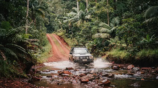
The park straddles the coastal strip between Innisfail and the base of the Atherton Tablelands, roughly a 1 to 1.5 hour drive south of Cairns depending on which access point you are heading for. The Mamu Tropical Skywalk and the Josephine Falls turn-off are both signed from the main highway; the western Bartle Frere trailhead is reached via roads closer to the Tablelands side and is less signposted, so hikers attempting that route should confirm directions before setting out rather than relying on general signage.
A hire car is genuinely useful for this whole southern coast pocket — day-trip coach tours generally do not stop at Bartle Frere’s more remote trailheads. For context on when a car is worth having versus relying on organised transport, see do you need a car in Cairns.
Nearby: rounding out a southern coast day
Wooroonooran National Park sits in a stretch of Tropical North Queensland that rewards slowing down rather than rushing between ticked-off sights. A few places worth building around a Bartle Frere or Skywalk visit:
Behana Gorge, closer to Cairns than Bartle Frere itself, is a separate freshwater swimming spot with its own access track and its own safety notes — it is not part of the Wooroonooran summit system, and it deserves its own visit rather than being squeezed in as an afterthought. See Crystal Cascades and Behana Gorge for the full picture.
Babinda Boulders, a short drive south, is a granite-boulder swimming hole with a serious safety history and a sacred significance to the Yidinji people. It is a worthwhile stop, but only with the safety rules read first: Babinda Boulders safety guide.
Innisfail, the nearest sizeable town, is worth a stop for its Art Deco streetscape, rebuilt after the 1918 cyclone. It sits close to both the Mamu Skywalk and the Bartle Frere eastern access.
Paronella Park, a little further south again, is one of the most unusual stops in the whole region — a ruined Spanish-style castle and gardens built from 1929 onward beside a waterfall. It pairs naturally with a Skywalk or falls visit on the same day.
Full detail at Paronella Park guide, and it is bookable as a tour that also takes in Lake Barrine and Millaa Millaa: a combined Paronella Park, Lake Barrine and Millaa Millaa day trip, or as a full-day option from Cairns with dinner included: Cairns: Paronella Park rainforest full-day tour with dinner.
Mission Beach, further south still, is the base for two of the region’s signature adventures: white-water rafting on the dam-fed Tully River, bookable as a full-day Tully River white-water rafting trip, and wildlife encounters at cassowary-spotting country, where the endangered Southern Cassowary sometimes wanders onto the beach itself. Families in particular tend to enjoy the animal encounters offered locally, such as this Mission Beach animal encounter and feeding experience.
For freshwater swimming options across the wider region beyond Josephine Falls and Babinda, see freshwater swimming holes near Cairns, and for general trip safety across the Wet Tropics, including river and estuary hazards, see travel safety in Tropical North Queensland. To fit Wooroonooran into a broader loop, best day trips from Cairns covers how it stacks up against other southern coast options like Innisfail and Tully River.
Wooroonooran and Country
The mountain and the forest around it sit on the traditional lands of the Mamu and Ngadjon-Jii peoples, whose connection to this landscape long predates the national park boundary drawn around it. That context is worth carrying with you on the track, whichever level of the mountain you choose to experience.
Planning the rest of your trip
If Bartle Frere and Wooroonooran are one stop on a longer southern coast route, it is worth reading up on the wider region before you commit a full day to any single hike. Destinations: Wooroonooran National Park has the practical location details, and Destinations: Josephine Falls and Destinations: Behana Gorge cover the swimming-focused spots this guide has deliberately kept separate from the summit hike.
Destinations: Babinda, Destinations: Innisfail, Destinations: Paronella Park and Destinations: Mission Beach round out the southern coast corridor this park sits within.
Frequently asked questions about Mount Bartle Frere and Wooroonooran
Can I climb Mount Bartle Frere in a day?
Fit, experienced hikers do complete it as a long day walk, but it is one of the hardest single-day hikes in Queensland, with a very early start required. Many parties camp overnight partway up rather than risk descending the steep, slippery track in the dark.
Is the Bartle Frere summit hike suitable for beginners or families?
No. This is Queensland’s highest mountain and the track is steep, root-strewn, often muddy, and largely without reliable water. It is a serious undertaking for fit, well-prepared hikers, not a casual walk.
What is the Mamu Tropical Skywalk?
It is an elevated boardwalk and viewing tower through and above the rainforest canopy over the North Johnstone River gorge, near Innisfail. It requires no hiking fitness and is suitable for most visitors, including families.
Can I swim at Josephine Falls?
Yes, in the designated lower pools and natural rock slide, which are separate from the Bartle Frere summit track that starts nearby. For full safety details on swimming there, see the dedicated Josephine Falls page rather than treating it as part of the mountain climb.
Do I need a permit to hike Mount Bartle Frere?
You do not need a permit for a day walk, but if you plan to camp overnight on the mountain you need a Queensland Parks and Wildlife Service camping permit, booked in advance.
How do the Skywalk, Josephine Falls and the summit hike connect?
They all sit within the same Wooroonooran National Park, on or near the same mountain, but they are separate access points with separate car parks. You cannot walk between them on the same visit; each is chosen as its own outing.
What is the best time of year to attempt the Bartle Frere summit?
The dry season, roughly May to October, gives the best chance of a clear track and less mud. In the wet season the upper mountain is frequently in cloud, the track becomes a watercourse, and cyclone-season closures are possible.
Guided hikes and nature walks on GetYourGuide
Verified deep-linked GetYourGuide tours. Book through these links and we earn a small commission at no cost to you.
GetYourGuide does not provide a product photo for this activity — the image shows the meeting point, photographed by us.