Babinda Boulders: The Swimming Safety Guide
Is it safe to swim at Babinda Boulders?
Yes, but only in the signposted upper pool by the picnic area, where the water is calm and shallow enough to see the bottom. The Devil's Pool downstream has claimed multiple lives and is fenced off for a reason — it is never a swimming option, however calm it looks.
One pool is a swim, the other is a warning
South of Cairns, where the granite ranges of the Wooroonooran National Park funnel Babinda Creek into a narrow gorge, sits one of the most photographed — and most misunderstood — swimming spots in Far North Queensland. Babinda Boulders looks, from the car park, like a straightforward tropical swimming hole: clear water, smooth granite, rainforest canopy overhead. It is that, in one specific, signposted place. A short distance downstream, the same creek becomes something else entirely, and that distinction is the single most important thing to understand before you go.
This guide exists to draw that line clearly, once, so you don’t have to guess it standing creekside. If you’re assembling a wider list of places to cool off around Cairns, our freshwater swimming holes guide and our Crystal Cascades and Behana Gorge guide cover the sites where the safe zone is easier to read at a glance. Babinda rewards a visit — it’s genuinely one of the most beautiful spots in the region — but it asks for more care than most.
Where Babinda Boulders sits, and why the water is so unpredictable
Babinda is a small sugar town roughly an hour south of Cairns, at the base of the ranges that rise toward Mount Bartle Frere, Queensland’s highest peak at 1,622m. The Boulders themselves are a short drive west of town, inside Wooroonooran National Park — the same park that contains Josephine Falls and the Mamu Tropical Skywalk canopy walkway.
Babinda holds a title that matters more here than almost anywhere else on this coast: it’s one of the wettest towns in Australia, averaging somewhere around 4,000mm of rain a year — more than double what Cairns itself receives. That number isn’t trivia. It’s the reason the creek at the Boulders can look completely different from one day to the next.
A storm in the ranges overnight, even one you never noticed from Cairns, can turn a gentle, clear creek into a fast, brown, debris-carrying flow by morning. There’s no tide table for this, no forecast you can check with confidence — the only reliable signal is what the water is actually doing when you arrive. If it looks high, fast, or discoloured, that’s the day to walk the track and skip the swim, not the day to test it cautiously.
The upper pool: where swimming is safe
The area everyone comes to swim in is the pool closest to the car park and picnic ground, sometimes called the Boulders Pool. It’s wide, comparatively shallow, ringed by smooth granite boulders, and slow-moving enough on a normal day that you can see the creek bed. There are picnic tables, a barbecue area, and a short interpretive walk, which makes this one of the more family-friendly freshwater stops in the region when conditions are normal.
Good practice here is the same as any unpatrolled natural swimming hole: there’s no lifeguard, so supervise children constantly and keep them toward the calmer, shallower margins rather than the middle of the pool. Check the current before you get in — even the “safe” pool moves faster after rain — and never swim alone if you can help it. If you want a broader sense of how this compares to other freshwater spots around Cairns, Lake Eacham on the Atherton Tablelands offers a calmer, more predictable alternative with none of Babinda’s downstream complication, and it’s covered alongside Lake Barrine in our crater lakes guide.
The Devil’s Pool: not a swimming option, ever
Follow the walking track a short way downstream from the main pool and the creek changes character completely. It narrows, drops through a channel of submerged and half-submerged boulders, and picks up speed. This stretch is known as the Devil’s Pool, and it is fenced, signposted, and closed to swimmers — not as an overcautious formality, but because it has killed people, including strong, experienced swimmers who underestimated it.
The mechanics of why it’s so dangerous are worth understanding, because they explain why “just being careful” doesn’t fix the problem. Below the surface, the channel is a maze of boulders and ledges that create surging currents, sudden drops, and pockets where a person can be pulled under and held against rock. The flow isn’t uniform — it can look glassy in one spot and be violently turbulent a metre away, and that pattern shifts as the water level rises and falls. There’s no vantage point from the bank that lets you read the danger accurately, which is exactly why the barrier exists rather than a warning sign alone.
Treat the Devil’s Pool the same way you’d treat any fenced hazard: as something to view from the platform above, photograph if you like, and then walk away from. Not paddle at the edge of. Not wade toward for a better photo. Not enter because the water looks unusually still that day. Every recorded fatality at this site involved someone who, in the moment, judged the water to be manageable.
Why this place is sacred, not just scenic
Babinda Boulders carries deep cultural weight for the Yidinji people, the Traditional Owners of this country, and the danger of the site is bound up with a story rather than separate from it. In Yidinji tradition, the creek is linked to Oolana, a woman whose story of forbidden love ends in tragedy at this exact place. Traditional Owners have long identified the gorge as spiritually significant and have warned visitors away from the Devil’s Pool specifically — a warning that predates the physical safety case by generations and arrives at the same conclusion from a different direction.
It’s worth sitting with that rather than treating it as decoration for a warning sign. This isn’t a scenic waterfall with an unfortunate current; it’s a named, storied place that the people who have known it longest have always described as one to respect rather than conquer. If that side of the region interests you, our guide to Traditional Owners of Tropical North Queensland covers how Country and culture connect across the whole area, from the Yidinji lands around Cairns to the Kuku Yalanji country further north around Mossman Gorge.
Reading the signage and the barriers correctly
Queensland Parks and Wildlife maintains fencing, signage, and a viewing platform at the Devil’s Pool specifically because verbal warnings alone haven’t been enough to stop people entering. If you visit with a group, it’s worth being the person who says the unpopular thing: the fence is not a suggestion, and “just for a photo from the rocks” is how a normal day turns into an emergency. There’s no phone signal to rely on if something goes wrong in the gorge, and the nearest help is a drive away, not a shout away.
The same rule that applies at the Devil’s Pool applies, in a gentler form, everywhere in Tropical North Queensland’s rivers and gorges: read the water on the day, not the water you saw in a photo. Conditions here are genuinely variable in a way that flatter, more temperate destinations rarely are. Our broader safety guide for the region covers the other side of freshwater caution up here too — this coastline’s estuaries and lower rivers hold saltwater crocodiles, which is an entirely separate reason to only swim where a site is explicitly signposted as a safe freshwater spot, as covered in our guide to seeing crocodiles safely.
Getting there and what to bring
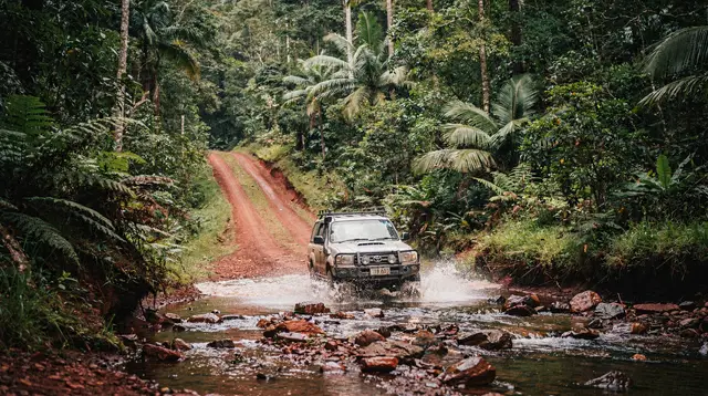
Babinda Boulders is roughly a 50-minute drive south of Cairns on the Bruce Highway, with a turn-off through Babinda township itself; there’s no public transport to the site, so it’s a self-drive or tour destination. The car park has toilets, picnic shelters, and the trailhead for the short interpretive walk to the Devil’s Pool lookout — allow 20 to 30 minutes for the walk if you’re not swimming, longer with kids or a picnic stop.
| What to bring | Why |
|---|---|
| Reef-safe sunscreen and a hat | Rainforest canopy is patchy; UV is high year-round |
| Insect repellent | Rainforest creek margins hold mosquitoes, especially at dusk |
| Water shoes or sturdy sandals | Granite boulders are slippery when wet |
| Cash or card for Babinda township | Limited facilities at the site itself |
| A plan for wet weather | Roads and creek levels change fast in the wet season |
If you’re driving, it’s worth building in flexibility rather than a fixed itinerary — a look at conditions on arrival should genuinely decide whether swimming happens that day. This is a good site to pair with a broader Tablelands or Babinda, Innisfail and Mission Beach loop rather than a single-purpose trip; Paronella Park, the extraordinary ruined castle and gardens at nearby Mena Creek, sits close enough to combine in one day, and it’s worth seeing regardless of what the creek is doing at the Boulders.
a full-day tour that combines Paronella Park’s rainforest ruins with dinner covers this loop without you needing to plan the drive or the timing yourself, which is one way to see this corner of the Wet Tropics without staking the day on creek conditions. There’s also a combined day trip to Paronella Park, Lake Barrine, and Millaa Millaa Falls, which trades the uncertainty of a single swimming hole for several reliably scenic and swimmable stops across the southern Tablelands.
When the wet season changes the picture
Babinda’s rainfall isn’t evenly spread across the year. The wet season, roughly November to April, is when the creek is most likely to be running high, fast, and unswimmable even in the upper pool — this is also cyclone season across the region, and heavy rain events can close access roads temporarily. If you’re travelling in the wet season and want a freshwater swim that’s easier to read, Crystal Cascades closer to Cairns and Lake Eacham on the Tablelands tend to be more forgiving, since neither has Babinda’s narrow, boulder-choked lower gorge concentrating the extra water into fast channels.
Outside the wet season, from roughly May to October, the creek runs lower and clearer more consistently, which is when the upper pool is at its most reliably swimmable — though “check on arrival” still applies, since a single upstream storm can shift things regardless of the season. For a fuller picture of how the two seasons play out across the region, our wet season guide is a useful companion piece.
If you’re building this into a wider Tablelands day
Babinda Boulders sits close enough to the southern Atherton Tablelands and Wooroonooran National Park that many visitors fold it into a longer loop rather than a standalone trip. Nearby stops worth considering on the same day include Josephine Falls, with its natural granite waterslide, and the Mamu Tropical Skywalk, an elevated canopy walkway through the same national park.
admission to the Mamu Tropical Skywalk canopy walk is a way to experience this rainforest from above rather than in the water, which is worth having as an option on a day when the creek at Babinda isn’t cooperating. And if the appeal of Babinda is really the wider idea of moving water in the Wet Tropics rather than swimming specifically, a day of white-water rafting on the Tully River near Mission Beach channels the same landscape into a controlled, guided activity with none of the ambiguity that makes the Devil’s Pool so dangerous.
A two-day loop through this part of the region — the Boulders, Josephine Falls, and the southern Tablelands — is covered in more detail in our Atherton Tablelands itinerary, which slots Babinda in as a half-day stop rather than the whole day’s plan.
The takeaway
Babinda Boulders is worth the drive: it’s one of the most striking granite gorges in the Wet Tropics, and the upper pool is a genuinely good, family-friendly swimming spot on a normal day. The rule that keeps it that way is simple and non-negotiable — swim in the signposted upper pool, never past the fence, and never at the Devil’s Pool regardless of how the water looks. Respect the barriers, respect the story behind them, and check the creek’s mood on the day rather than trusting a photo from someone else’s trip.
Guided hikes and nature walks on GetYourGuide
Verified deep-linked GetYourGuide tours. Book through these links and we earn a small commission at no cost to you.
GetYourGuide does not provide a product photo for this activity — the image shows the meeting point, photographed by us.